
Tide Pocket
Early accessUS, UK and EuropeFree app
NOAA tide times for major US stations, a tide curve and a 7 day table offline.
Early access. The app works in your browser today; the Android app follows when enough people ask for it.
NOAA tide times for major US stations, a tide curve and a 7 day table offline.
Early access. The app works in your browser today; the Android app follows when enough people ask for it.
Tide Pocket shows NOAA tide predictions for major US stations in a fast, simple layout: the next high or low, today's curve and a seven day table. Save the stations you use and the last download stays on your phone for when you lose signal at the beach.
How it works
Real screens from the app, filled with example data.
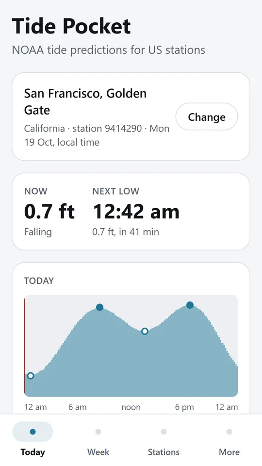
Open the app and see whether the water is rising or falling, the height now and the next high or low with a countdown. In the example, San Francisco is NOAA station 9414290.
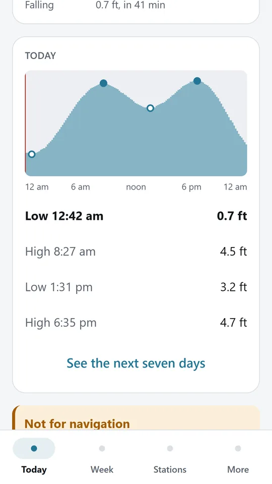
The curve shows the highs, the lows and a line for now, with each high and low listed below in the local time of the station.
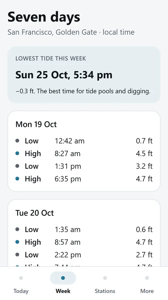
Every high and low for the next seven days, with past tides greyed out and the lowest tide of the week picked out for tide pools.
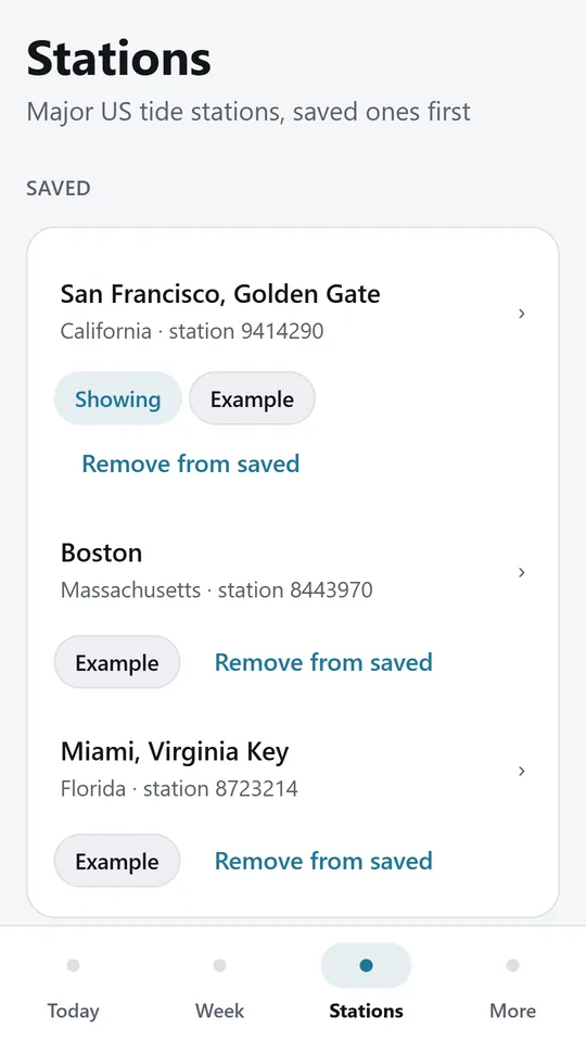
Save the stations you use and switch between them. The last download for each is kept on the phone, so the tables still work offline.
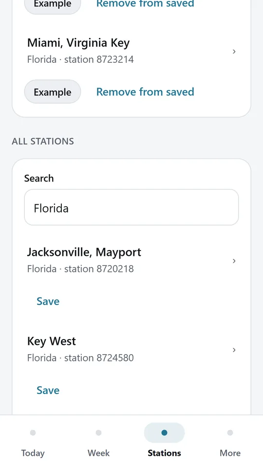
Search the built in list of major NOAA stations by town, state or station number. In the example, a search for Florida lists Jacksonville and Key West.
Try it now
This is the real app running in your browser, with nothing to install. Tap around, type your own numbers and see what you get. What you enter stays in this browser.
Reminders work only in the phone app.
What it does
Open the app and see whether the water is rising or falling, the height now, and the time and height of the next high or low with a countdown.
A curve shows the whole day with the highs, the lows and a line for now, so you can see when the water will be where you need it.
Every high and low for the coming week, day by day, with the lowest tide of the week picked out for tide pools and clamming.
Search a built in list of major NOAA reference stations on the Pacific, Atlantic and Gulf coasts, Alaska and Hawaii, and save the ones you use.
The last predictions for each station are saved on the phone. The app tells you when you are looking at a saved copy and when it was downloaded.
Heights are above mean lower low water, the datum on US charts, in feet or metres. Times are the station's local time.
Predictions are astronomical tides. Wind, air pressure and river flow change the real water level, so never rely on this app to navigate. Tide Pocket is an independent app and is not linked to NOAA.
Use it in your browser now, no account.
The phone app needs no signal.
What you enter stays on your device.
Contact
Tide Pocket is in early access: the browser demo works today and the phone app follows when enough people ask for it. Tell us how you would use it and we will invite you first.
No newsletter and no selling of your details. Read how we handle messages in the contact privacy note.